Green Infrastructure in existing city
The problem of excessive soil sealing and the consequent macro-micro climate degradation process need specific measures. The use of standards and indexes finalized to the regulation of soil permeability permits flexible and resilient solutions that allow environment to find a new balance.
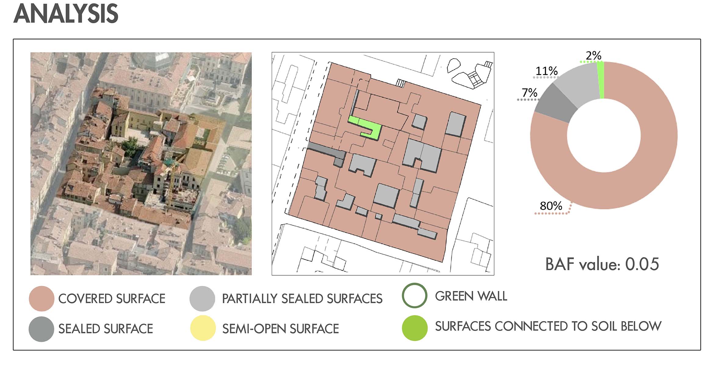
The method called BAF – Biotope Area Factor express the portion of the area devoted to green or to other ecosystem functions that contribute to achieving environmental quality.
BAF = ecologically effective surface / total land area

With reference to the general goals of sustainability, the BAF index is able to provide a parametric measure about:
- preservation of the micro-climate and the atmosphere;
- check of land and water use;
- improvement of the quality of plants’ life and animals’ habitat;
- improvement of living space for the human being.
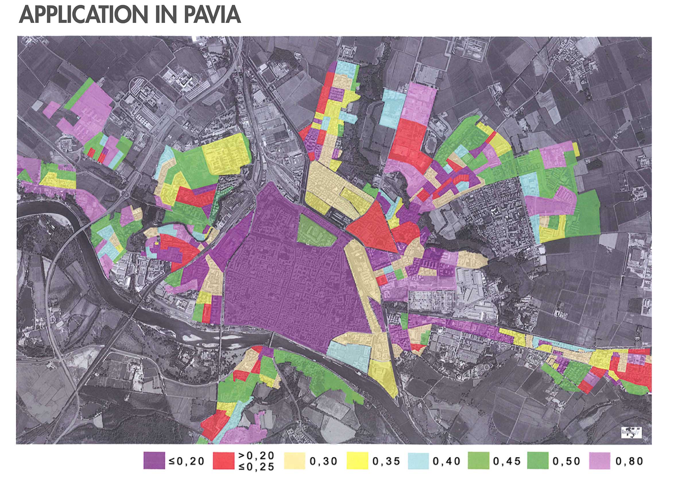
Application in Pavia
BAF calculation (and the creation of related thematic maps) involves a big amount of editing work including the use of orthophotos and bird view images (surces: Google Maps, Bing Maps, Google Street View) as well as direct surveys on the field. This operating mode, suitable for specific cases’ application, is more expensive, in terms of time, widening the field of investigation to the urban scale (existing city). All the information can be also downloaded from Lombardy Region digital maps: Pavia’s map is stored in an ESRI geodatabase and is preferably exported in the ESRI shape format. Pavia’s map is a good representative of the large-scale maps which are owned by many Italian municipalities. The map has a very detailed classification of its content, which can be used to effectively associate a BAF coefficient to each map’s feature.